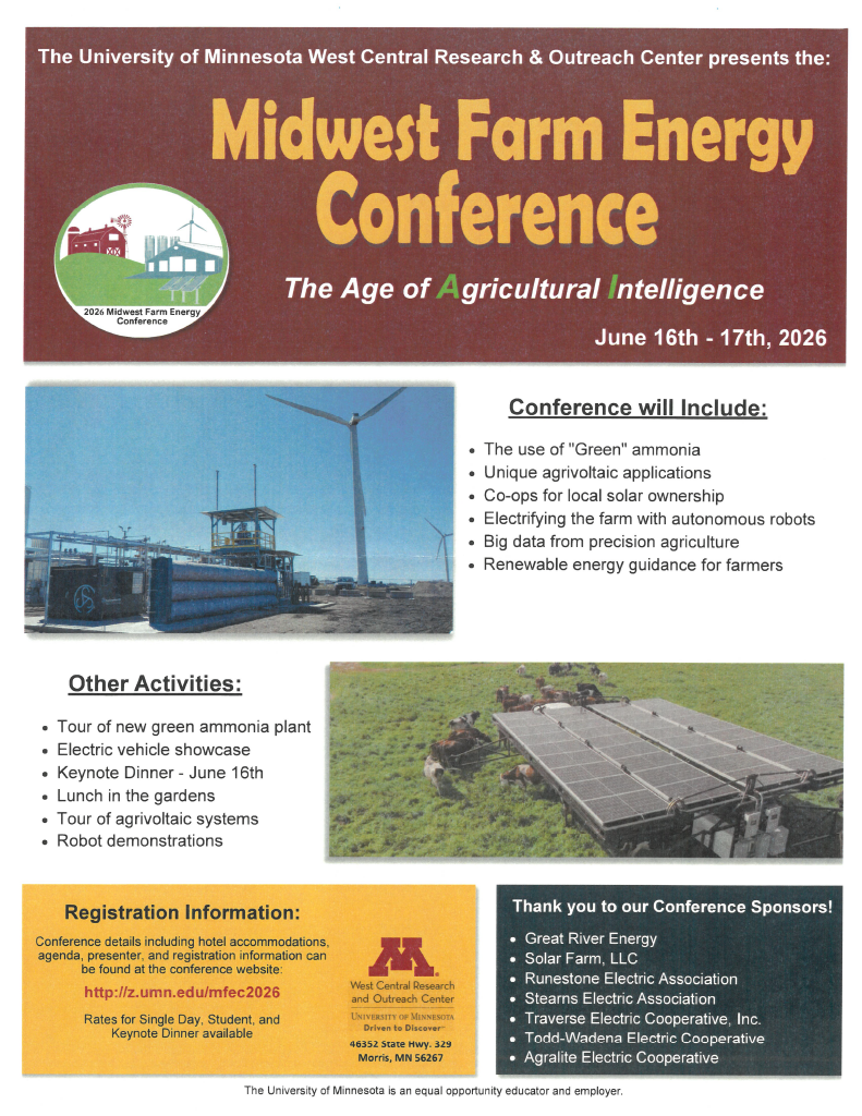
Midwest Farm Energy Conference
The University of Minnesota West Central Research & Outreach Center presents the 2026 Midwest Farm Energy Conference, June 16–17 in Morris. This year’s theme is “The Age of Agricultural Intelligence,” featuring green ammonia, agrivoltaics, local solar ownership, farm electrification, autonomous robots, precision agriculture, and renewable energy guidance for farmers. Activities include tours, robot demonstrations, an […]